Projection
This section describes the “Projection” controls for generation of the model grid.
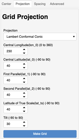
Projection
Three grid projections are supported:
Mercator
Lambert Conformal Conic
Stereographic
Please see Cartopy projection list for more details on these projections.
The gridtools library attempts to conform to Proj terminology for setting projection parameters such as latitude of true scale.
Here is a comparison of Cartopy mapping parameters to parameters for use with Proj and Gridtools:
Cartopy
Proj
Gridtools
central_latitude
lat_0
lat_0
central_longitude
lon_0
lon_0
standard_parallels
lat_1, lat_2
lat_1, lat_2
latitude_true_scale
lat_ts
lat_ts
Tilt is allowed to be specified for all projections. Conformality of Lambert Conformal Conic grids has been confirmed with usage of a tilt value that is non-zero.
Setting of false_easting or false_northing values is not implemented.
See also:
setGridParameters().